Jauljibi is a small town in Pithoragarh District where there is sangam of Gori and Kali River. This town lies near the natural border of India and Nepal. After this Dharchula lies from which people go to Kailash Mansarovar Yatra.
Jauljibi bridge connecting India and Nepal.
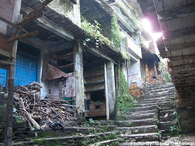
Jauljibi fair is also a very famous fair in Kumaon. Above and below are the pictures of Bagadi Hat in Jauljibi.
Munsiyari being very close to the Panchchuli Range, one can see the peaks very clearly and close to proximity. There is a point Khalia Top from Ratapani. It is higher than Munsiyari and one can see full Range very very clearly.
Panchchuli Peaks during sunset from Munsiyari.
This is Messar Kund near Munsiyari where there is a meadow and small Kund.
Munsyari is the name of a town and a tehsil in the Pithoragarh District. It lies at an altitude of 7200 feet. There are three ways to come here but can be blocked during rains.
This is TRH Munsiyari.
This is the Panchchuli Peak II towering at 23000 feet. This can be seen clearly from anywhere in Munsiyari. This is a base point for trekkers to go to Milam Glacier.
These are the small villages on the opposite mountin to Munsiyari as seen from Munsiyari. As you can see the town goes till higher than Munsiyari. People have to walk a lot here.
Gori Ganga river lies in Munsiyari, Pithoragarh. Gori Ganga river source is from Milam Glaciar. Gori Ganga river later meets with Kali river in Jauljibi town.Picture shown is of Sangam of Gori Ganga the right one with its tributary the blue one.
Gori Ganga flowing through the steep mountains in Pithoragarh district.
Full Panchchuli Range taken from Munsiyari.The peaks represents the 5 pandavas cooking hearth (panch chulis) (Hindi - chula - cooking hearth) They prepared their last meal here before leaving for heaven.
Panchchuli II - 23000 feet (Highest). This is highest of all 5 peaks.
Panchchuli I - 21180 feet
Panchchuli II - 23000 feet (Highest)
Panchchuli III - 21040 feet
Panchchuli IV - 21113 feet
Panchchuli V - 21456 feet
Dharchula is a small hilly town in the Pitthoragarh district of Uttrakhand, India. In Hindi ‘Dhar’ means peak and ‘Chula’ means stove. Dharchula is surrounded by the mountains of the Kumaun region and it is situated on the bank of the river Kali at the Indo- Nepal border. This is Dharchula town (India) surrounded by steep mountains.
Other side town is of Nepal. Seperated by natural boundary of Kali River.
This is Dharchula at Night. Theres a bridge like Jhula Ghat from which one can cross the Kali river. At night 7:00 PM the bridge is closed. Guarded by Military forces.
One can see Himalayas at the background. Dharchula acts as a base camp for trekkers wh go for Adi Kailash, Om Parvat, Kailash Mansarovar. Dharchula indeed has the best location inspite of being low in altitude.
Kali River flowing.
Beautiful valleys and river along Dharchula
High mountains and valleys while going to Gunji via Dharchula. The Dharchula - Kailash Mansarovar route is truly enriched with scenic beauty.
Jhulaghat is a village on the Indo-Nepal border, 36 Kilometers far from Pithoragarh. Both sides of the towns are called Julaghat and Jhulaghat. Through the bridge one can go across Kali to Nepal. Kali is natural border between India and Nepal. Musical Ramlila in Jhulaghat is played during the winter for more than 105 Years
The Pithoragarh town is located at a height of 1645 meters above sea level.East longitude along the eastern and southern part of the central Himalayas with Indo-Tibbetan watershed divide in the north and the Kali river forming a continuous border with Nepal in the east. Photo is taken from Chandak route.
These are the step farms in Pithoragarh.
This is the view from TRH KMVN of Pithoragarh. Roads are very good and this lies on the Chandak Mandir route.
Pithoragarh milestone showing 30 kms.
Pithoragarh Valley. Mountains are very steep in Pithoragarh area.
Pancheshwar Mandir lies at the sangam of Kali and Saryu River. Pancheshwar Mandir is very old. People tie bells and red scarfs around the Mandir. This place lies at 1400 feet above sea level and the location is very good. There is silence everywhere and one can hear only the clashing of two rivers. Nice place for peaceful meditation
Pancheshwar lies at the sangam of two rivers i:e Saryu and Kali Rivers
This is Pancheshwar bridge built upon Saryu River. One has to cross this in order to reach the Sangam point and Mandir.
This is the mighty Saryu River taken from above the bridge . One has to cross this to reach Mandir.
The first picture shown is of Panchchuli Peak seen during sunset from the KMVN hotel at Didihat. On a clear day one can see Panchchuli and Trishul mountains.
Above are the step farms of Didihat taken from the KMVn hotel at Didihat. Didihat is situated on the hill top plain of 'Digtarh' and river Charamgad or Bhadigad streaming below. Below the town there is a fertile 'Haat valley'
Photo above is of Didihat town. It is at a height of 5700 feet. It is quite a big town with lots of shops. Didihat is named after Kumauni language word 'Dand' means a small hillock.
Places to see: Sirikot Mandir of lord Malaynath built by Reika Kings.