KUMAON VERSION - Namaste Guest, Thank you for giving your value time on this page, suggestions and feedbacks are welcomed ...

Monday 31 October 2011

Khurpatal

Khurpatal is surrounding with bright green farms that make it a very attractive town. This is a remote town at a height of 5500 feet appx. This town comes on the way while going to Nainital. This is a small town but located beautifully among the mountains and mist. One can have a short hault here. The Tal is shape like a trowel or shovel and is very small tal. One can say that Khurpatal is like a small county or a countryside town.
This is a Rocky mountain near Khurpatal. As you can see where the sun is shining there are hard rocks as soil. Nothing can grow there as roots cannot penetrate.

Old Petrol Pump in Dharchula

Old petrol pumps are still there in Uttarakhand. One guy was rotating the pump while other was filling. There was a confusion between two of them. This was at Dharchula. Both of was as if new to the pump.

Roads in Uttarakhand

Roads in Uttarakhand are very good. During monsoons there might be problem due to land slides and wash away, but overall roads are smooth and nice.
Night driving is not recommended. Street lights are unavailable. Photo shown is near the town hence street lights are there otherwise one has to rely on car's headlight.
Sometimes the road gives away (Rasta Dhas Gaya). This is how it looks. Road is strong but the mud underneath is wet and loose. Once it gives away even the strong roads cracks. This was in Kanda and we had to drive over it.


Sometimes the rocks falls from above and gets collected or streams from top of the mountain bring down chunks of rocks onto the road. This is what it looks like. These can be dangerous because it guides the steering wheel itself. This usually happens in heighted places. This was in Madkot while going to Munsiyari. Our car's silencer was knocked out. So be sure you take high chassis vehicle.
Avoid these roads. These are roads in which water collects along with mud and then makes it slimy. If a car tyres goes inside its too difficult to remove it even when pressing full accelerator as wheels just rotate freely in the mud making it sink deeper. Only jeeps can pass such bad road. This was in Munsyari and we had to leave our car behind and board a jeep.
See more Uttarakhand roads photos

Farming in Magnasite, Takula

Magnasite is a place nearby Takula. It contains a cement making industry. There are plains in these area in which farms are big. Picture shown is of a man farming in Magnasite.
Farms in Magnasite

Big Gourd and Cucumbers

Gourds and cucumbers grown here are very big in size. Some can be a meter long. The gourd shown here is quite big and fat. Vegetables grown here do not use artificial fertilizer. They use cow dung or horse dung. All natural fertilizers vegetable taste good and full of nutrients. And if you want to buy some, it will cost you more than an artificial fertilizer one.

Hanuman Temple, Naukuchiya Tal

There is a huge Hanuman statue on the way to Naukuchiya Tal from Bhimtal. The statue is about 3 storey high. This beautiful statue of Hanuman guards the Mandir. One can have a stop in this Mandir to pay Darshan.


  Neem Karoli Baba Temple,Naukuchiatal
 Artificial cave in Naukuchiatal Hanuman Mandir


Karuli, Bageshwar

Small group of houses which merge together into a Khetwal community in Uttrakhand. There are many small villages in Uttarakhand and Karuli is one of them situated 12 KM from Bageshwar. It lies in Bageshwar district of Uttrakhand. Post office is at Chidang.


Beautiful scenic village situated between valleys of Kapkot and Kanda. 
Small perennial stream flowing and meets with Pungar River. There is a wheat pounding house which is run by this stream.
Karuli is a small village with less population and full of forests. Karuli lies in a valley are where there are many trees.
Many types of fish resides in this village. Mode of transport to this village is by local jeeps or personal vehicle. Local jeeps take Rs 30 from Bageshwar. Roads are very narrow in this village. There is a temple in this village which is very old.
Pungar River flowing through Karuli, Pungar River then meets the Saryu River at Balighat and at the sangam point is a small Temple where a saint used to meditate. Pungar River Has its source from Mount Shikhar.
Large chunks of rocks in Pungar River.
These are stepped field alongside the Pungar river.
Mountain range opposite side of Karuli village.

 Harvesting season in the fields.

KARULI VIDEO (PART 1)

Balighat

This is Saryu River flowing. At Balighat there is a sangam point of Saryu and Pungar River. The photo is taken from Balighat Pul (Bridge). Balighat is surrounded by mountains. From Balighat there is a division from which one can go to Kapkot and another towards Karuli, Dophad, etc to Kotmanya.

Mount Shikhar, Bageshwar

Mount Shikhar is at the height of 9000 feet above sea level where during the winters 5 to 6 feet of snow falls. The mountain on back is Mount Shikhar and a Mandir is located there.
This is a temple of Mool Narayanan up in the Shikhar. A saint lives up here all by his self. 
One can see all the panoramic himalyas from this point.
Usually all the pujas are performed here during festive seasons.

This is a baba who lives up there. If one is visiting this temple, take something to eat as well as give since very less people climb up there. There's no electricity up there due to remoteness, hence beauty is maintained.
This is a cave up there which is very deep and extends as it has no ends. Water here is very cold and sweet. Womens are not allowed here. This place is very sacred.
Hills nearby Mount Shikhar

Nainital

Nainital during sunset. Nainital is always covered in mist.  Far back there is Naina Peak or Chena Peak. Highest point of Nainital.
Chhapeli performed by men who also play the role of women, dance is popular in Nainital.
Photo taken from Thandi Road. Night time looks best from here. Nainital Lake is called Tri-Rishi-Sarovar, hinting at the story of three sages (or rishis), Atri, Pulastya and Pulaha, who, upon finding no water in Nainital, dug a large hole at the location of the present day lake (sarovar = lake) and filled it with water from the holy lake Manasarovar inTibet. According to lore, a dip in Naini Lake, "the lesser Manasarovar," earns merit equal to a dip in the great lake.
This is Nainital taken at night.
Being close to Haldwani. One can see Haldwani down there from Nainital. View of Haldwani from Nainital
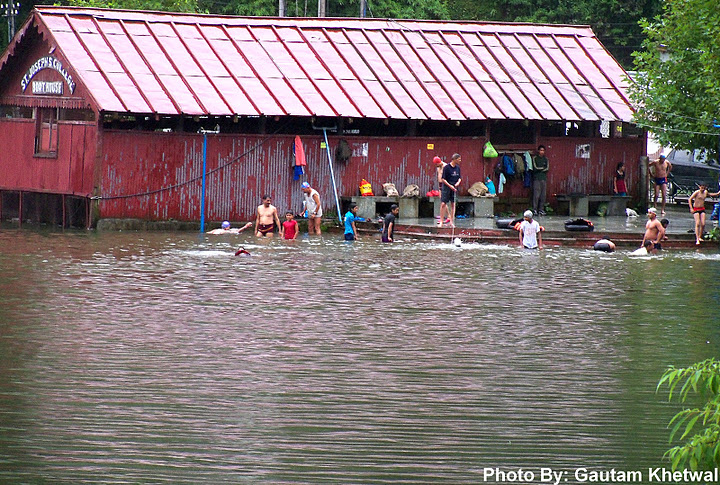
Early morning swimming, boating is performed.
Man in his meditation in early morning
Thandi Road, Nainital 
 This is Nainital seen from below from a place called Gethia.

Bhimtal

Bhimtal is an ancient place named after Bhima of Mahabharata. Bhimeshwara Mahadev Temple, an old Shiva temple in the bank of Bhimtal lake, is believed to have been built when Bhima visited the place during the banishment.
Small island in Bhimtal
Man fishing on Bhimtal Lake

Baijnath, Bageshwar

The Baijnath temple has a gather of many temples; the most famous of them is Bhairav, Dattatreya, Ganga Mata, Haniman, Durga, Kalika & Vaneswar temples. It is located at the heart of city. Lying in the Katyuri valley, 19 Kms away from Kausani and 26 kms far from Bageshwer, is the small but ancient town of Baijnath.
 Beautiful Baijnath among the Himalayas alongside Gomti river.


Related Posts Plugin for WordPress, Blogger...