KUMAON VERSION - Namaste Guest, Thank you for giving your value time on this page, suggestions and feedbacks are welcomed ...
Wednesday, 20 November 2013
Sakar Village, Almora
Location:
Sakar, Uttarakhand, India
Tuesday, 19 November 2013
Monday, 18 November 2013
Mandalsera Matiyoli, Bageshwar
Labels:
Bageshwar
Location:
Bageshwar, Uttarakhand 263642, India
Nadigaon, Bageshwar
Location:
Bageshwar, Uttarakhand 263642, India
Kansyari, Bageshwar
Location:
Kansyari, Uttarakhand, India
Katyuri Valley, Garur, Baijnath
Beautiful Katyuri Valley. Himalayas at the background and Garur and Baijnath as seen in the picture. Katyuri kings established Baijnath as their capital and built many temples. The valley hence came to be known as Katyuri valley. Valley extends towards Kausani. Garur and Baijnath are two major towns located in the plains.
Baijnath built by Katyuri Kings alonside Gomti river. Lots of huge fishes are present in the pond formed by the Gomti river. At its full power, the Katyuri kingdom extended from Nepal in the east to Kabul in the west.
Labels:
Baijnath,
Garur,
Katyuri Valley
Location:
Garur, Uttarakhand, India
Someshwar, Uttarakhand
Location:
Almora, Uttarakhand, India
Kafligair, Bageshwar
Location:
Jatha, Uttarakhand, India
Nau Gaon, Kakrighat
Kakrighat, Almora
Beautiful valley of Kakrighat. The route is pretty straight here.
Kosi River flowing between Kakrighat.
Above is Sombari Baba Maha Samadhi & well preserved remains (Old Hut, Raj Asan, Lingam and Holy Trees). It is under management of Shri Neem Karoli Baba's
Kainchi Dham Ashram - Neem Karoli Baba lived and meditated at this place
under guidance of his GuruDuring period of 1890 swami Vivekananda meditated under a Pipal tree at this place during his travel to Himalayas.
Kosi River carving Kakrighat
Location:
Almora, Uttarakhand, India
Lohali, Uttarakhand
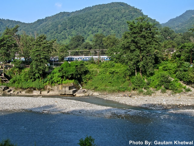
Gaula River, Kathgodam, Uttarakhand
Gaula river is an essential river draining in Kathgodam with a length of 500 km appx. It arises from the nearby gola hills and is also fed by many tributaries. It later merges with Ramganga river in Uttar Pradesh. A dam has been built known as Gaula Barrage in order to make a reservoir which supplies water for cities like Kathgodam and Haldwani. Irrigation is done as well. Gaula river bed is wide as it drains off. Gaula catchment and surround land has become prone to landslides due to severe abuse of quarrying, deforestation and waste disposal. Due to such reasons the flow rate of the river has also diminished.
Above is the photo of Kathgodam Railway station situated aside the Gaula River. It is the last station towards the hills.
Subscribe to:
Comments (Atom)


